
Axta rayonu
14-01-2025, 18:45
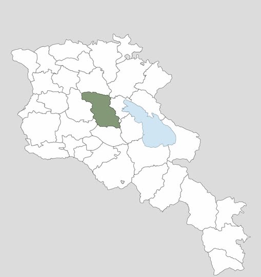
Axta rayonu 1930-cu il sentyabrın 30-da yaradılmışdır. Sahəsi 936 km² olan rayonun inzibati mərkəzi Axta (Hrazdan) şəhəri olmuşdur. Buradan İrəvan şəhərinə olan məsafə 50 km-dir. Axta rayonu ərazisindən Zəngiçay və onun qolu Böyükçay axır.
Rayonun ərazisi tarixi İrəvan xanlığının Dərəçiçək və Qırxbulaq mahallarına, Çar Rusiyası dövründə isə İrəvan quberniyasının Novo-Bəyazid qəzasına daxil olmuşdur.
Toponim oğuz tayfalarından olan padarların bir qolunu təşkil edən “axtaçı” (axta) etnonimindən formalaşmışdır.
Ermənistan SSR Ali Soveti Rəyasət Heyətinin 30 iyun 1959-cu il tarixli fərmanı ilə rayonun adı dəyişdirilərək “Hrazdan” qoyulmuşdur.
1987-ci ildən rayonun əzəli azərbaycanlı sakinləri yaşadıqları yerləri tərk etməyə məcbur edilmişlər. 1995-ci ildə isə rayon ləğv edilərək Ermənistanın Kotayk vilayətinin inzibati ərazisinə daxil edilmişdir.
----
Akhta district was established on September 30, 1930. The administrative center of the district, which has an area of 936 km², was the city of Akhta (Hrazdan). The distance from here to the city of Yerevan is 50 km. The Zangichay and its tributary Boyukchay flow through the territory of Akhta district.
The territory of the district was historically included in the Derechichek and Kirkhbulag districts of the Iravan Khanate, and during the period of Tsarist Russia, it was included in the Novo-Bayazid district of the Iravan province.
The toponym was formed from the ethnonym "akhtachi" (akhta), which formed a branch of the Padars from the Oghuz tribes.
By the decree of the Presidium of the Supreme Soviet of the Armenian SSR dated June 30, 1959, the name of the district was changed to "Hrazdan".
Since 1987, the original Azerbaijani inhabitants of the district have been forced to leave their places of residence. In 1995, the district was abolished and incorporated into the administrative territory of the Kotayk province of Armenia.
Xəbəri paylaş